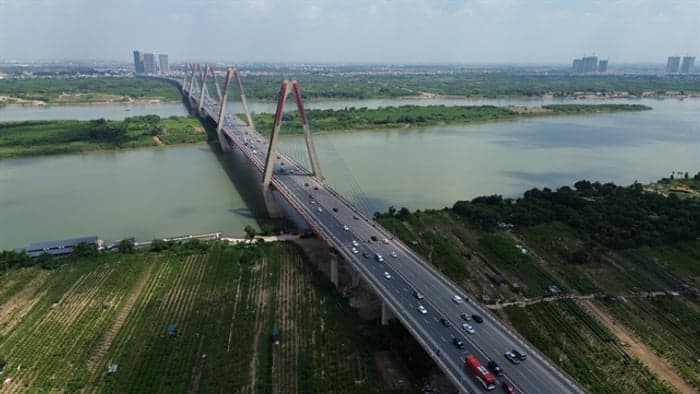
Hanoi has approved an adjustment to the Red River urban zoning plan. The plan aims to develop the river corridor as a strategic green, ecological and multi-functional urban axis for the capital, with a projected population of 800,000 to 1.2 million.
The adjustment was approved by Hanoi People's Committee Chairman Vu Dai Thang under Decision 6075.
The revised plan covers more than 11,418ha between the Hong Ha and Me So bridges, spanning 16 wards and communes.
It includes 16 administrative units: Thuong Cat, Dong Ngac, Phu Thuong, Hong Ha, Bo De, Long Bien, Linh Nam, O Dien, Me Linh, Thien Loc, Vinh Thanh, Dong Anh, Bat Trang, Thanh Tri, Nam Phu and Hong Van.
Under the adjustment, the Red River will become a central green and strategic spatial corridor for culture, innovation, economic activity, commerce, services and urban development.
The areas along both banks will help shape Hanoi's identity as a city of civilisation, identity and creativity.
The plan follows three principles: safety, ecology and transport connectivity. It gives priority to flood prevention, dike safety and climate change adaptation.
Urban development, land use and infrastructure construction in riverside areas must be assessed through hydrological and hydraulic modelling.
The projected population of 800,000 to 1.2 million is the maximum threshold for calculating land requirements and infrastructure capacity.
Actual population levels will depend on flood drainage and dike safety conditions and must be approved by the relevant authorities.
The planning proposals draw on hydrological and hydraulic modelling and an assessment of flood drainage impacts for the Red River Scenic Boulevard Investment Project conducted by the Vietnam Academy for Water Resources.
Individual projects will still require further assessments to ensure flood safety and compliance with dike regulations.
If calculations show that these requirements cannot be met, authorities will consider revising the zoning plan.
Preserving traditional villages
The river corridor will be organised in layers, with wetlands and flood-prone areas closest to the river, followed by parks, green spaces and public squares.
Tourism services and relocatable low-rise structures will be located in less flood-prone areas. Zones near the dike will accommodate mixed-use developments, including commercial services, offices, housing, healthcare and education.
The corridor is divided into three sections with distinct development orientations.
The section from Hong Ha Bridge to Thang Long Bridge will focus on ecological landscapes, nature conservation, traditional villages, sports facilities, research and experiential centres, and low-density urban development.
High-rise buildings will be concentrated in the Chu Phan-Trang Viet area and around Thuong Cat Bridge, linked to transport hubs.
The section from Thang Long Bridge to Thanh Tri Bridge will become a mixed-use development hub with cultural and arts centres, international trade and finance facilities, tourism services, innovation spaces and parks, alongside new urban and resettlement areas.
On the right bank, an Urban Living Room will combine urban parks with the redevelopment of existing residential areas and multi-functional spaces.
The left bank will accommodate modern urban developments, public facilities and diverse housing, with parks along both banks and the central alluvial land.
A landmark tower is also planned along the West Lake-Cổ Loa axis.
The section from Thanh Tri Bridge to Me So Bridge will focus on urban and ecological tourism parks, recreational facilities and experiential activities, integrated with cargo and passenger ports and inland waterway terminals.
The plan also prioritises the preservation of long-established communities, traditional craft villages, historical and cultural sites and riverside community institutions.
Areas outside the dike will be classified into three groups: those retained for upgrading under certain conditions; those requiring partial relocation for flood safety or essential infrastructure; and those designated for urban redevelopment.
Traditional craft villages and historically significant settlements will receive priority for preservation of their core areas, infrastructure improvements and controlled development.
Areas that fail to meet flood safety requirements or fall within planned transport and infrastructure corridors may be relocated for redevelopment.
The central development area of the corridor covers the area within Ring Road 2 between Nhat Tan and Vinh Tuy bridges, together with other designated residential areas.
Resettlement and multi-purpose urban developments are planned in the communes of Linh Nam, Long Bien, Bo De and Bat Trang.
In the initial phase, the city will prioritise the scenic boulevard along both riverbanks, public parks in Phu Thuong and Hong Ha wards, the Urban Living Room area, resettlement developments in Linh Nam and Long Bien wards, and a standalone site clearance project.
Sources: Viet Nam News