
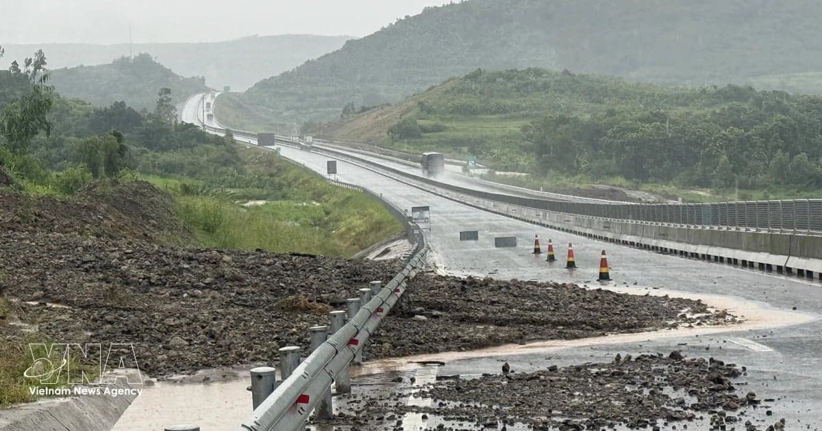
According to updates from local authorities in the central region as of 5 p.m. on November 12, heavy rains in recent days damaged provinces and cities from Thanh Hoa to Dak Lak.
On November 12, rainfall from 40 to 100 mm was recorded in areas from Hue city to Khanh Hoa province, while Dak Lak received 80 to 200 mm. Some places recorded more than 300 mm. Particularly heavy rain fell around My Lam Lake and Da Ban Stream in Dak Lak, Tam Tra in Da Nang and Ba Cung in Quang Ngai.
The floods injured two people in Hue, destroyed one house in Quang Ngai, blew the roofs off 47 houses and damaged another 41 in landslides. As of the afternoon of November 12, 2,734 houses remained inundated, including 1,857 in Gia Lai and 877 in Dak Lak.
Flooding also affected 235 hectares of crops, including 121 hectares in Thanh Hoa, 5 hectares in Quang Tri and 109 hectares in Dak Lak. A total of 9,850 poultry and 14 livestock animals were killed or swept away, while 82.3 hectares of aquaculture ponds were inundated.
The irrigation system was also affected. Landslides and other damage hit 4,190 metres of canals, while silt filled the headworks of five weirs in Quang Ngai.
Many national, provincial and rural roads were hit by landslides and flooding. Floodwaters on National Highway 19C in Long Thach hamlet, Dong Xuan commune, Dak Lak, cut road access to the Xuan Lanh-Dong Xuan area, leaving Ha Rai and Lanh Cao hamlets completely isolated.
Authorities in provinces and cities from Thanh Hoa to Dak Lak evacuated 1,887 households from high-risk areas, including 1,195 in Dak Lak, 266 in Da Nang, 153 in Thanh Hoa, 151 in Quang Ngai, 102 in Gia Lai and 20 in Hue. Some localities suspended classes in flood-prone and riverside areas and deployed personnel to direct traffic at flooded crossings and landslide sites.
Prolonged heavy rain triggered serious landslides on key roads and inter-commune routes in mountainous areas of Da Nang, disrupting traffic and isolating residential areas. Local authorities mobilised personnel, excavators and specialised vehicles to clear debris and restore traffic.
In Thanh Binh commune, traffic on the National Highway 40B section at Deo Lieu Pass was largely restored by 10 a.m. on November 12. Clearance work was also accelerated in Tra Tan, Tra My and Nam Tra My communes. With the risk of further landslides remaining high, local authorities are maintaining round-the-clock emergency duty and warning residents to avoid flooded crossings and dangerous landslide areas.
The National Centre for Hydro-Meteorological Forecasting warned that moderate to heavy rain and thunderstorms would continue from the evening of November 12 to the morning of November 13 in Hue, Da Nang and eastern areas of provinces from Quang Ngai to Gia Lai. Rainfall in the central region is forecast to gradually ease from the afternoon of November 13.
At 3 p.m. on November 12, the Ve River in Quang Ngai had risen 0.4 metres above Alert Level 2. Several other rivers in Hue, Da Nang, Quang Ngai and Gia Lai were above Alert Level 1.
Rough seas, strong winds and thunderstorms were also forecast in several coastal areas, with risks of waterspouts and strong gusts. Localities were urged to closely monitor weather and flood developments and take measures to protect residents and property.
Sources: VietnamPlus / Vietnam News Agency