
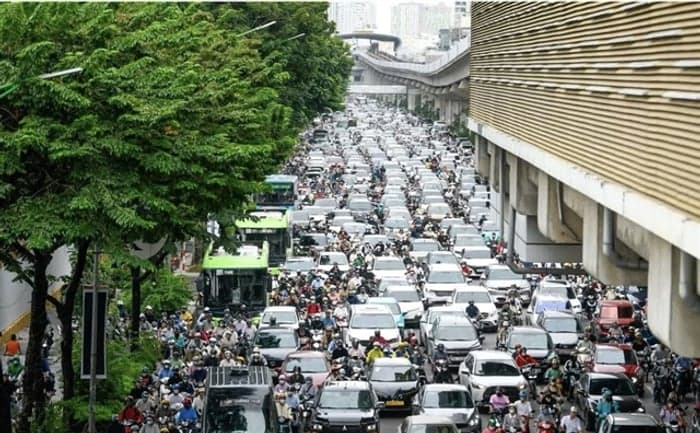
Average traffic speeds on some major roads in central Hanoi have fallen to just over 12 km/h during peak hours. The Hanoi Department of Construction said the figures support a shift towards a system centred on mass public transport.
The department has completed its review of the planning brief for the capital's transport master plan with a 100-year vision and submitted it to the municipal People's Committee for consideration and approval.
The submitted materials include survey data showing declining traffic speeds in the inner city. Average speeds are 21.02 km/h during off-peak hours and fall to 15.54 km/h during peak periods.
The sharpest declines were recorded on major roads including Tran Duy Hung, the Ring Road No. 3 section at Pham Hung, the Ring Road No. 2 section at Lang and Giai Phong.
Congestion is largely linked to heavy reliance on roads and private vehicles. Motorbikes account for 82.3 per cent of traffic volume and occupy 52.5 per cent of road space. Passenger cars account for 12.2 per cent of traffic volume and 26 per cent of road space.
The capital's two urban railway lines and one bus rapid transit, or BRT, line serve only around 4.8 per cent of travel demand. The plan materials say that widening roads alone is no longer enough to resolve congestion.
The proposed plan is intended to turn the capital's broader master plan, approved under Decision No. 2512/QD-UBND on May 13, 2026, into a long-term transport strategy.
It covers Hanoi's entire natural area of nearly 3,360 square kilometres and takes regional transport links with neighbouring localities into account.
The proposed transport network will be linked to a multi-tiered urban development model built around nine economic corridor axes, nine growth poles and nine major centres.
According to Truong Viet Dung, vice chairman of the Hanoi People's Committee, the plan covers more than individual infrastructure projects. It also seeks to reorganise the capital's overall spatial structure and the way people travel.
The main priority is to make urban rail the backbone of public transport. Radial, ring and cross-city lines are to connect directly with major interchange hubs, including airports and railway stations.
Bus services and feeder routes will connect passengers to the urban rail network. The plan also includes coordinated measures to support walking, cycling, shared transport and park-and-ride facilities.
For road transport, the plan assigns functions to different road classes. Ring roads will divert traffic and connect growth poles, while radial routes will link those areas with the central urban core.
The municipal appraisal council approved the planning task. The next phase will develop detailed proposals for the transport network.
Sources: Viet Nam News